
Overview
About Mount Harriet (Mount Manipur National Park)
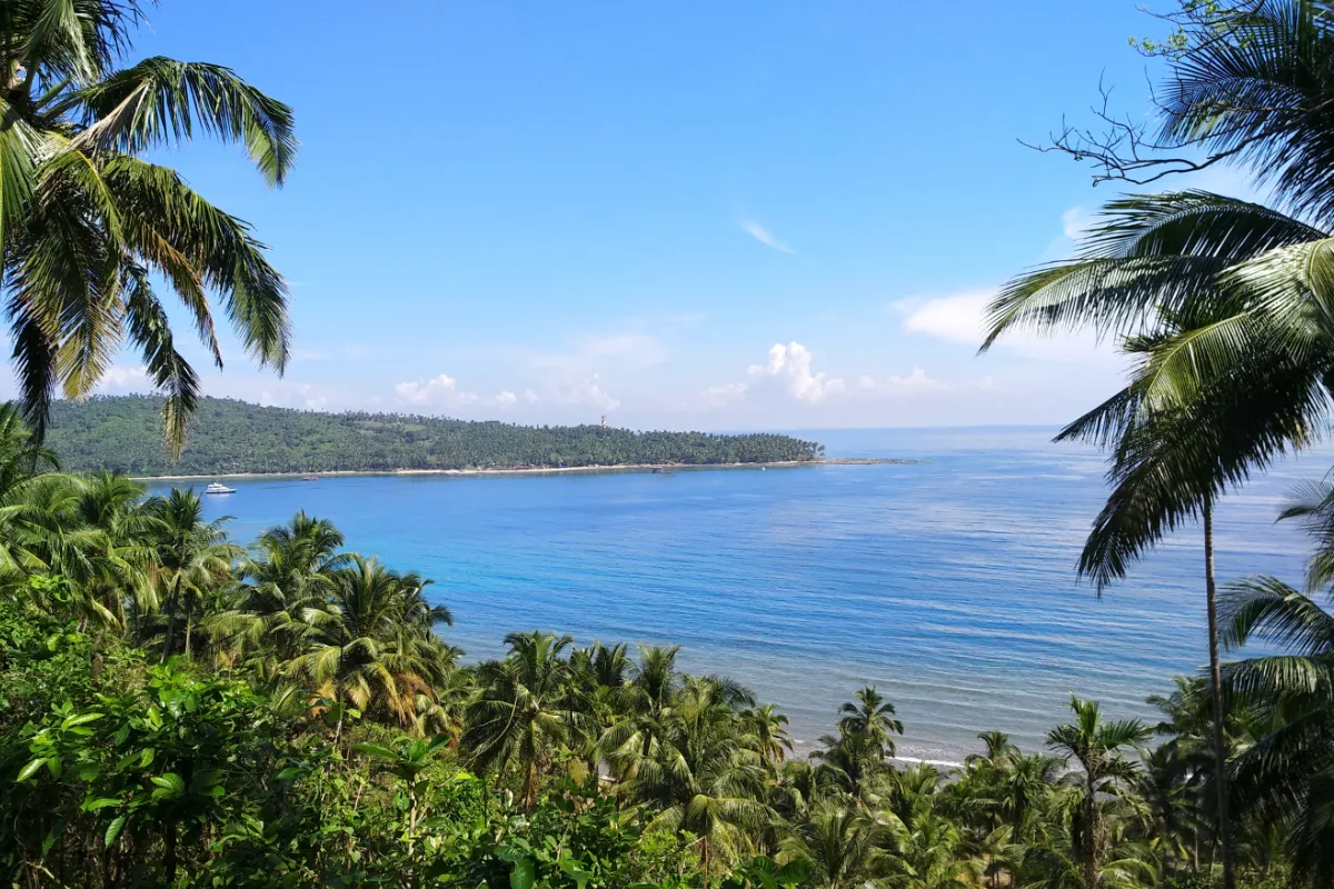
Mount Harriet is the highest point in South Andaman at 365 metres, and the view from the top is the one on the back of the Indian ₹20 note: the harbour spread out below with North Bay's lighthouse on the far headland. Standing at the viewpoint with a twenty-rupee note held up to compare is a small tourist ritual, and it works.
The hill was the British summer headquarters — the Chief Commissioner moved up here in the hot months — and the old bungalow site, water tanks and a memorial remain near the summit. In 2021 the peak and the park around it were renamed Mount Manipur, commemorating the Manipuri princes and fighters deported here after the Anglo-Manipur war of 1891.
The national park is the real draw for anyone who likes forest. It is tropical evergreen at its densest, with Andaman wild pig, several endemic birds and an exceptional variety of butterflies — the Andaman species list here is one of the richest in India. The Kala Pathar trek runs about sixteen kilometres through the park down to Madhuban beach and takes most of a day; shorter marked nature trails loop from the summit road in under an hour.
Getting there is part of the experience. The direct route is a ferry across the harbour to Bamboo Flat and a winding road up; the road-only route around the bay is about fifty-five kilometres and takes far longer.
Why people come here
- Highest point in South Andaman at 365 metres
- The harbour panorama engraved on the ₹20 note
- Tropical evergreen national park with exceptional butterfly diversity
- Kala Pathar trek down to Madhuban beach
- Colonial summer-headquarters ruins near the summit
Things to do
What to do here
The ₹20 note viewpoint
A short walk from the summit car park to a cleared platform looking over the harbour and the North Bay lighthouse.
Nature trails around the summit
Marked loops through evergreen forest. Best in the first hours of the day for birds and butterflies.
Kala Pathar trek to Madhuban
Roughly 16 km of forest trail descending to the coast. Take a Forest Department guide — the route is not consistently marked.
Butterfly and bird watching
One of the best places in the islands for Andaman endemics and for the archipelago's butterfly list.
Getting there
How to reach
Ferry and road
Ferry from Port Blair's Chatham or Phoenix Bay jetty to Bamboo Flat, then about 15 km by road to the summit.
Road only
Around 55 km by cab from Port Blair via the harbour road — slower, but it removes the ferry timings from the plan.
Permits
Entry ticket at the park gate; the long trek needs Forest Department permission and, in practice, a guide.
Best time to visit · November to April, early morning
Clear mornings give the harbour view; haze builds through the day. Forest trails get slippery and leech-prone in the monsoon, though the park itself stays green and beautiful.
Good to know
Travel tips
- Take an early ferry — the last return crossings to Port Blair are well before dark.
- Closed shoes on the trails, and repellent. Leeches are a real thing here after rain.
- Carry a ₹20 note for the viewpoint photograph. Everyone does it, and everyone forgets.
- No food or water beyond the gate — bring your own for the day.
- Do not attempt the Kala Pathar trek without a guide and an agreed pickup at the far end.
Gallery
Mount Harriet (Mount Manipur National Park) in pictures
Port Blair (South Andaman)
Combine it with
Tour packages